The Pléiades constellation is the optical component of the Franco-Italian ORFEO (Optical and Radar Federated Earth Observation) observation system, whose objective is to cover civilian and military needs for high-resolution remote sensing data. The radar component is provided by the COSMO-SkyMed constellation.
Several other European countries have also participated in the Pléiades programme: Austria, Spain, Sweden and Belgium. Belgium, represented by BELSPO, contributes 4% of the cost of the programme, in continuity with its cooperation with France within the framework of the SPOT programme.
In return for this participation, Belgian institutional users - governments, research institutes, universities, etc. - can buy the data at unbeatable prices. Even better: if a certain set of data has been acquired by one user, all other users can obtain these data free of charge.
To implement these advantages, BELSPO has developed an online platform called Pléiades 4 Belgium ![]() . Here you can learn what Pléiades has to offer, view the data in the archive and check whether you meet the conditions for becoming an authorised user.
. Here you can learn what Pléiades has to offer, view the data in the archive and check whether you meet the conditions for becoming an authorised user.
Once logged in, you will get free and open access to all images in the Belgian archive. You will get a vastly reduced price on the order of both new acquisitions and images from the Airbus Defence & Space archive via the Airbus Geostore ![]() .
.
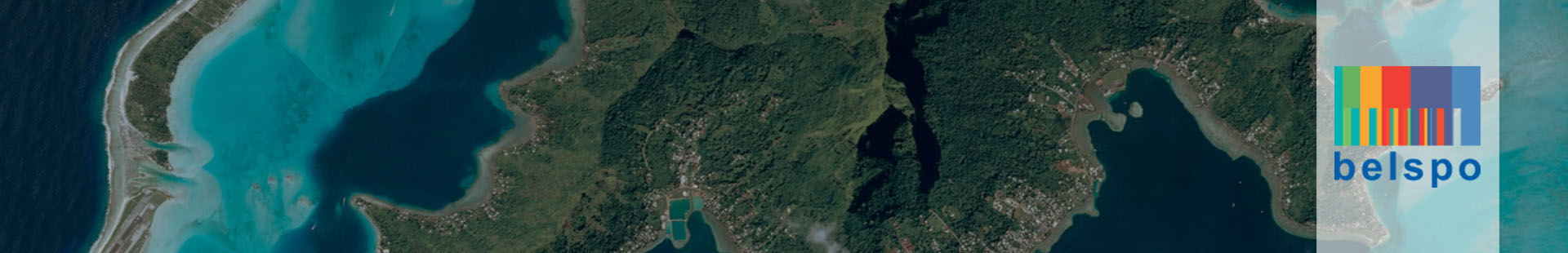
Currently, the Pléiades 4 Belgium platform contains hundreds of images from all over the world and this archive is constantly growing.
Currently two Pléiades satellites are operational: Pléiades 1A, launched on 17 December 2011, and Pléiades 1B, launched on 2 December 2012. Both satellites, developed and operated by Airbus Defence and Space ![]() , have the same optical instrument on board: HiRI (High-Resolution Imager).
, have the same optical instrument on board: HiRI (High-Resolution Imager).
This instrument delivers panchromatic data with a resolution of 70 cm, resampled on the ground at 50 cm, as well as multispectral data (blue, green, red and near infrared) with a resolution of 2.8 m, resampled at 2 m. The fusion of these two types of images enables colour images to be obtained at 50 cm resolution.
The data collected can be used in many applications: cartography, urban development, agriculture, forestry, geology, hydrology, marine environments, earth sciences, resource management, land use, ...
Pieter Rottiers
Space Research & Applications